Spatial Anomaly Detection
An automated detection tool for anomalous data is necessary for subsurface modeling and prediction in big, spatial data set. We proposed a spatial anomaly detection method that is able to integrate the domain expertise to assist data-driven segmentation while honoring spatial context from input data.Our proposed method provides a practical solution to assess anomalous regions by assigning a useful probability for the occurrence of specific pairs of sample data. We recommend the application of the proposed method as an automation tool in big, spatial datasets to focus professional attention.
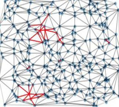
Utilize a model of spatial continuity (e.g. the variogram) to determine spatial anomalies.
- Spatial data outliers, data quality issues
- Local non-stationarities to guide data segmentation
- Work also includes a variety of univariate, multivariate anomaly detection methods for continuous and categorical reservoir properties
 |
Wells by well discontinuity probabilities |
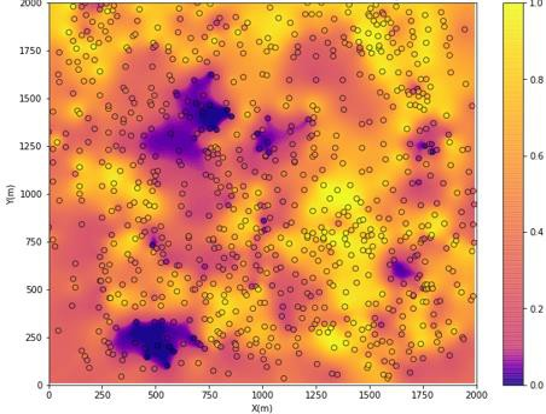
Spatial anomaly map |