DATA ANALYTICS
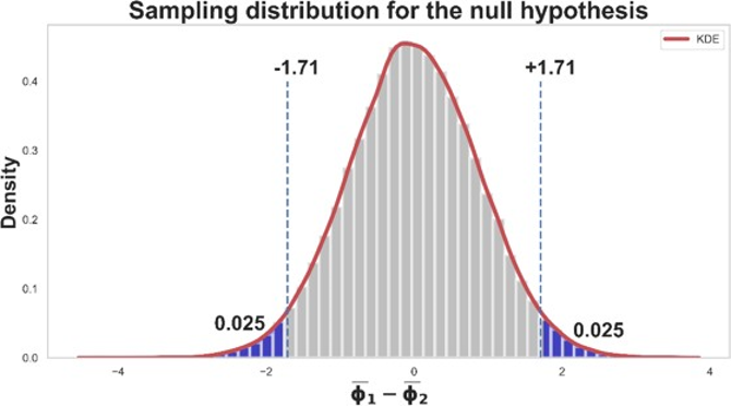
Off-the-shelf data analytics neglects the spatial correlation of subsurface data. Neglecting the spatial context imposes biased models and yield unrealistic/overoptimistic predictions. Also, the constant presence of geological trends is an opportunity to develop an automatic and reliable workflow for modeling trends. We address these problems by modifying hypothesis testing and automating the modeling of geological trends while honoring spatial data. The results provide support for decision making for future drilling and subsurface modeling. We recommend applying these methods to provide reliable, accurate estimates and robust models in the presence of data paucity.
Spatial and Multivariate Data Imputation
- Methods that integrate spatial and multivariate data for imputation of missing data with uncertainty
Spatial Hypothesis Testing
- Robust methods to evaluate difference in well sets
- Methods to test trend models
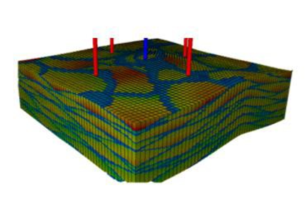
Truth model and well pads 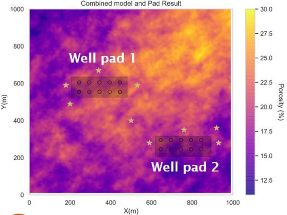
|
|
| Work by Salazar (supervised by Pyrcz and Lake) and Liu (supervised by Pyrcz). |
Accurate well-log interpretation is important for reservoir evaluation near well bores. However, conventional well-log interpretation techniques do not give accurate results in heterogeneous reservoirs. We develop a workflow using feature engineering and machine learning methods to incorporate the spatial continuity and geological concepts of the reservoir into the interpretation process. We find that machine learning methods successfully learn the geological concepts (patterns) and use them to give more accurate well-log interpretation results and better capture the flow conduits and barriers along the well.
We recommend the use the new workflow when accurate well-log interpretation is needed, and core data are available for validation. Development of new features that integrate spatial information into machine learning and other types of models.
Dispersion variance to calculate the variability / heterogeneity along a long horizontal well. 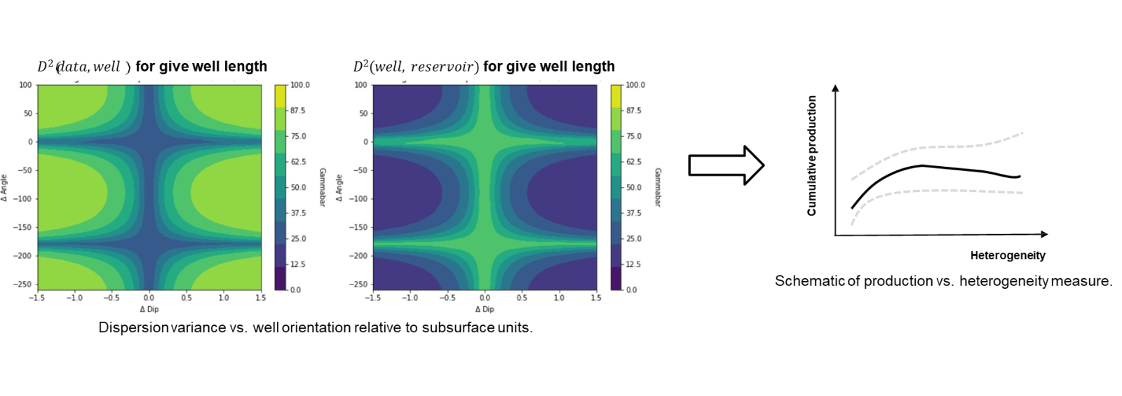
|
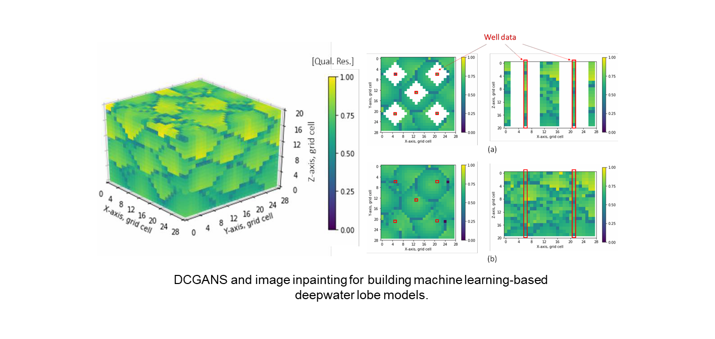
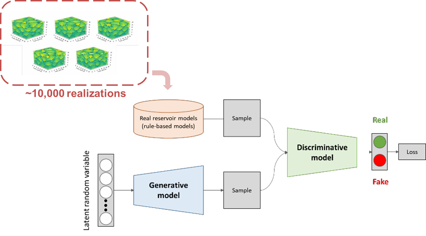
Deep convolutional generative adversarial networks to build reservoir models.
- Efficient exploration of uncertainty through the latent space manifold
- Precise well data conditioning and complicated architectures.
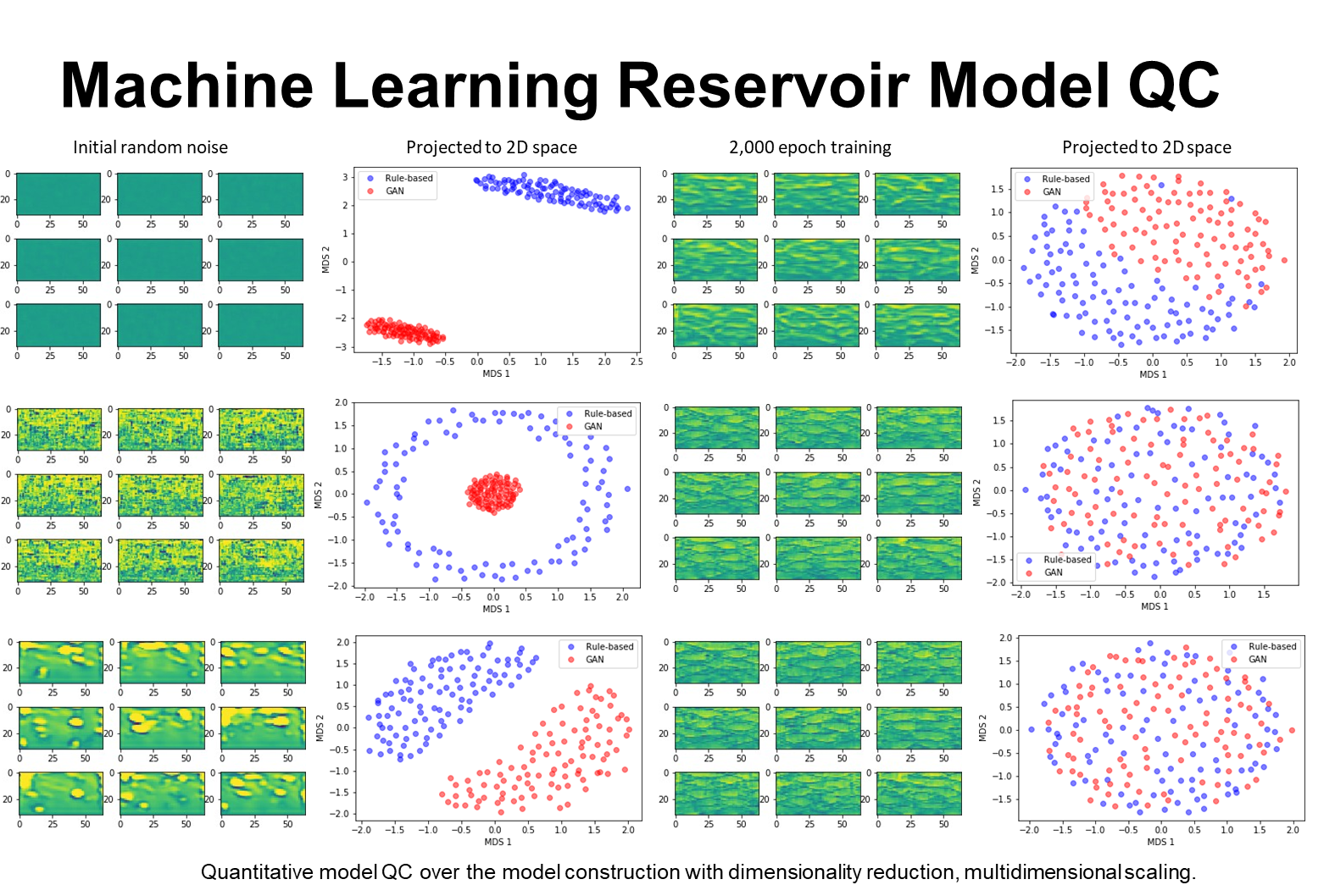
- Started work on model QC, and production data / history matching.
Work by Honggeun Jo (supervised by Pyrcz).
|
Machine learning-based subsurface models with generative adversarial networks
|
Machine learning-based subsurface models have excellent reproduction of the input heterogeneity 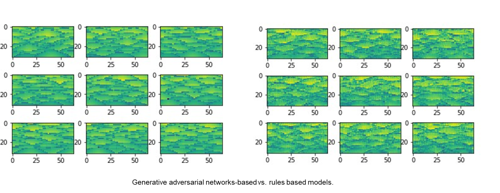
|
|
SEISMIC DOWNSCALING
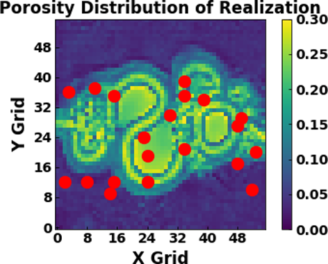
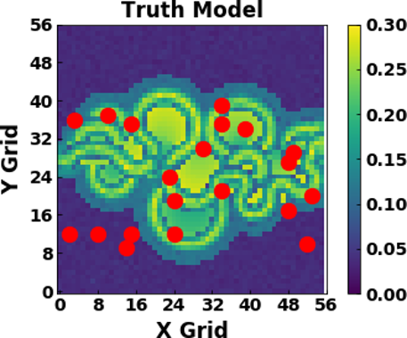
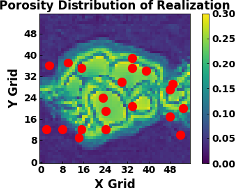
Reservoir models that honor field data and geological concepts are more likely to accurately forecast production and help risk analysis. However, few current methods can efficiently generate these useful models. We develop a new machine learning method Stochastic pix2pix. With this method we can efficiently generate reservoir models that match seismic, well-log and production data, and thus help decision making in reservoir development. We find correct geological concepts and accurate field measurements give accurate production forecasts, but a wrong geological concept and inaccurate measurements can introduce bias into the production forecasts. we recommend the use the new method for reservoir modeling when only small uncertainties are in the depositional environment.
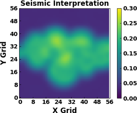
Model high resolution reservoir architecture realizations from low resolution seismic information.
- Training from rule-based channel models upscaled from element to complex scale.
- Pixel-2-Pixel method learns relationships between element and complex scale architecture.
- Integration of well and seismic conditioning, full reservoir model.
| Seismic complex-scale constraint and 3 machine learning-based element scale realizations conditional to wells (red dots) | ||
| 
| |
| 
| |
Work by Wen Pan (supervised by Torres-Verdin and Pyrcz).
Spatial Anomaly Detection
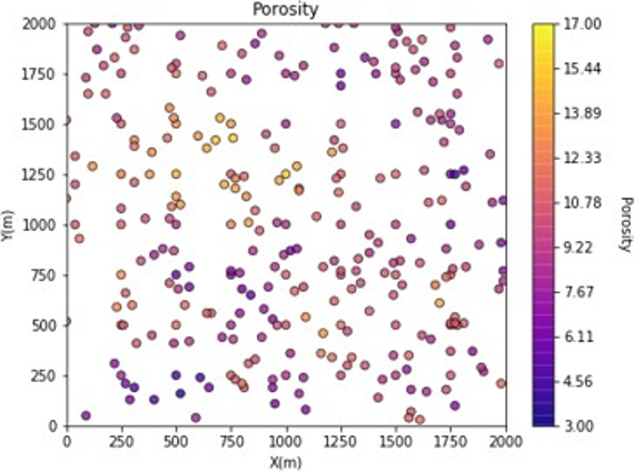
An automated detection tool for anomalous data is necessary for subsurface modeling and prediction in big, spatial data set. We proposed a spatial anomaly detection method that is able to integrate the domain expertise to assist data-driven segmentation while honoring spatial context from input data.Our proposed method provides a practical solution to assess anomalous regions by assigning a useful probability for the occurrence of specific pairs of sample data. We recommend the application of the proposed method as an automation tool in big, spatial datasets to focus professional attention.
Utilize a model of spatial continuity (e.g. the variogram) to determine spatial anomalies.
- Spatial data outliers, data quality issues
- Local non-stationarities to guide data segmentation
- Work also includes a variety of univariate, multivariate anomaly detection methods for continuous and categorical reservoir properties
|
Wells by well discontinuity probabilities 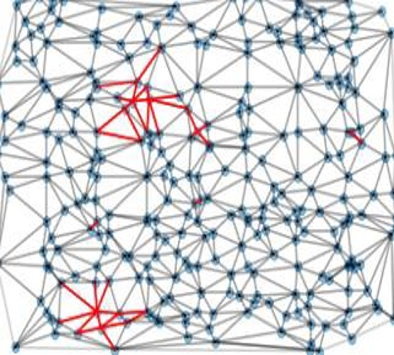
|
Spatial anomaly map 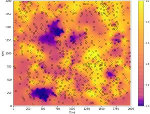
|
Work conducted by Wendi Liu (supervised by Pyrcz)
TRAINING MODELS
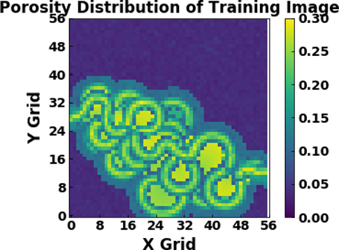
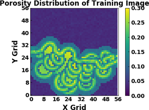
Fast, efficient, rule-based, grid-free, surface-based channel and lobe, fluvial and deepwater reservoir property models.
- Training data machine learning
- Reservoir Models conditional to wells, seismic and production
- Flow relevance, optimum data collection and development strategies
- Value of information and multiscale studies
- Flow surrogate development
|
|
|
Work by Honggeun Jo (supervised by Pyrcz) and Wen Pan (supervised by Torres-Verdin and Pyrcz)